GRAND CENTRAL & MOSQUITO PASSES
5/13/2007
5/13/2007
Ken Shapiro (06/07 Iron Dog Partner) and I took a trip into the
Kigluaik Mountains on May 13, 2007. This is (probably!) the last
trip of the winter. The weather was unseasonably cold, in the low
teens, and good, firm snow.
 Copyright © 2011, Ramon Gandia
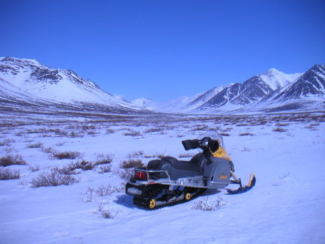
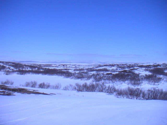
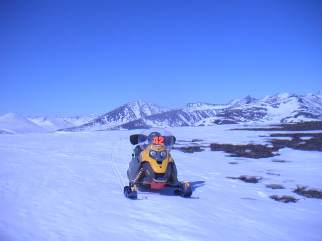
Here is my modified 2007 SkiDoo Tundra at the south entrance of
the Grand Central of Alaska. This is a wide valley, with the
Grand Central river flowing south out of the mountains. Here
Kenny is beyond me perhaps a mile; we are close to the road yet
where we trailered to (32 road miles from Nome, Alaska).
Copyright © 2011, Ramon Gandia
Here is my modified 2007 SkiDoo Tundra at the south entrance of
the Grand Central of Alaska. This is a wide valley, with the
Grand Central river flowing south out of the mountains. Here
Kenny is beyond me perhaps a mile; we are close to the road yet
where we trailered to (32 road miles from Nome, Alaska).
 Copyright © 2011, Ramon Gandia
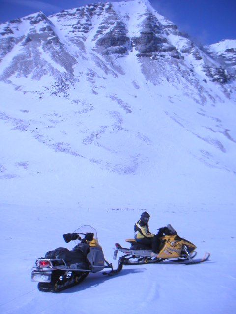
Grand Central Pass
(Above)This is Kenny on his 2006 SkiDoo MXZ 550F. He is an artist on
that machine! The picture above has him pointing at the pass, out of
sight to the right. In the background is one of the many spectacular
"bowls" that flank the passes. They generally have perfect powder
snow, and this one was no exception.
 Copyright © 2011, Ramon Gandia
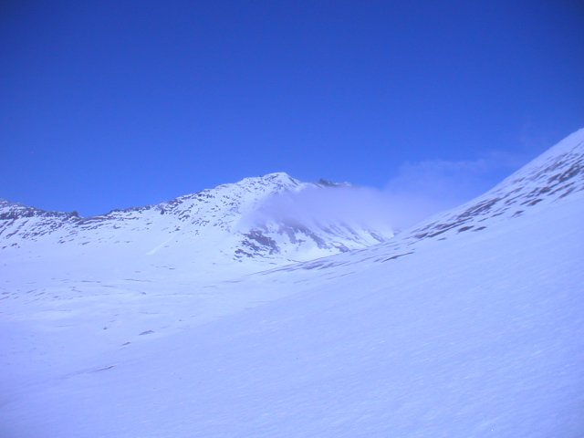
(above)South entry to the pass itself. It is a bit tricky to
find, but if you go north on the Grand Central 'till you get to the
big boulders, then continue north rather than follow the river west,
you will come into an area that opens up. At the north end is this
notch. Can't see it here, but if you go up the notch, you will have
to climb to about the 2,000 ft elevation to crest the pass. The
south side approach is not very steep, and most drivers and machines
should handle it okay. The drop on the north side is very steep, and
takes a bit of guts to go down. Not everyone will be able to return
that way!
Copyright © 2011, Ramon Gandia
(above)South entry to the pass itself. It is a bit tricky to
find, but if you go north on the Grand Central 'till you get to the
big boulders, then continue north rather than follow the river west,
you will come into an area that opens up. At the north end is this
notch. Can't see it here, but if you go up the notch, you will have
to climb to about the 2,000 ft elevation to crest the pass. The
south side approach is not very steep, and most drivers and machines
should handle it okay. The drop on the north side is very steep, and
takes a bit of guts to go down. Not everyone will be able to return
that way!
 Copyright © 2011, Ramon Gandia
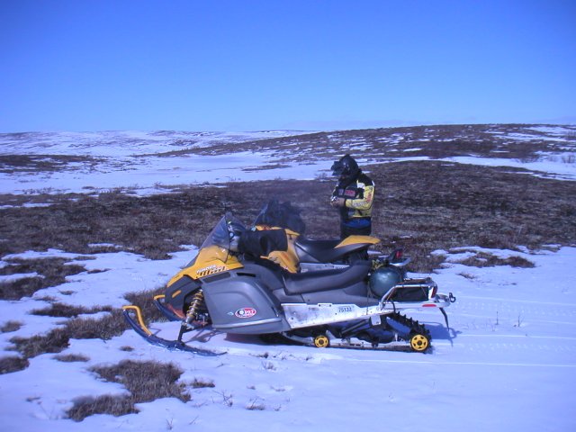
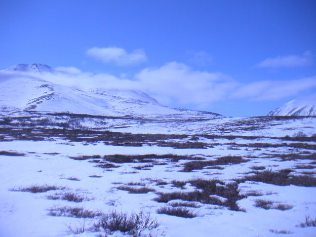
North of the Kigluaiks
(Above) Not too much snow at the lower elevations! But the tundra is
nice and soft, so it was not an issue.
 Copyright © 2011, Ramon Gandia
(Above) These are glacial moraines. The ground is very broken up,
with numerous rock piles, ridges, plateaus, ponds, and small lakes
of every conceivable shape, all at different elevations. In the
background is the Pilgrim and Kuzitrin Rivers. The abandoned
village of Mary's Igloo is there somewhere, and Mary's Mountain out
of sight to the right. This is beautiful country, but very, very
remote!
Copyright © 2011, Ramon Gandia
(Above) These are glacial moraines. The ground is very broken up,
with numerous rock piles, ridges, plateaus, ponds, and small lakes
of every conceivable shape, all at different elevations. In the
background is the Pilgrim and Kuzitrin Rivers. The abandoned
village of Mary's Igloo is there somewhere, and Mary's Mountain out
of sight to the right. This is beautiful country, but very, very
remote!
 Copyright © 2011, Ramon Gandia
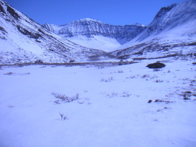
North Entrance to Mosquito Pass
(Above) The entrance to Mosquito Pass approaching from the north.
We are still in the glacial moraines, to the east of the Cobblestone
River, which in turn empties into Salt Lake (Imuruk Basin). Notice
the mountains to the right and left of the pass ... they are quite
distinctive when approached from the north.
 Copyright © 2011, Ramon Gandia
Within Mosquito Pass
(Above) This is one of the spectacular side valleys off Mosquito
Pass. This one goes into the east and ends up in a vertical rock
wall. Kenny went in along the bottom, and finally could not go in
any further: too narrow, flowing creek, obstacles. Maybe with more
snow, next year! I elected to go to the right of the notch, up on
that sidehill up there where I found a place to perch myself and
take the next picture.
 Copyright © 2011, Ramon Gandia
(Above) I am now above the notch or creek in the previous
picture. The camera angle is such that the camera is pretty well
pointing at where we were when the a previous picture was taken.
This was not a comfortable place. It looks flat and level, and it
was for a hundred feet or so, but it really was quite precipitous.
I am about 500 feet above the creek that Kenny followed in.
Copyright © 2011, Ramon Gandia
(Above) I am now above the notch or creek in the previous
picture. The camera angle is such that the camera is pretty well
pointing at where we were when the a previous picture was taken.
This was not a comfortable place. It looks flat and level, and it
was for a hundred feet or so, but it really was quite precipitous.
I am about 500 feet above the creek that Kenny followed in.
 Copyright © 2011, Ramon Gandia
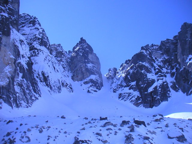
Looking at the Caldera
(Above) About halfway through the mountains, on Mosquito Pass,
you will climb to the head of the pass. This is not too steep of
a climb, but during some soft, deep snow years may be a challenge.
It was easy for us this time. Right at the top of the pass, to the
west, is this blown out volcano cone. The caldera inside the cone
is filled with water in the summer, but in the winter it freezes.
The picture is looking west, and shows the remaining walls of
the cone, and at the bottom you can see a gargantuan rock pile from
what broke off the cone walls. This happened recently ... who knows
exactly when? But you can see the pink face where rocks recently
sheared off. This picture was taken with both of us inside the
Caldera, which is quite an adventure in itself.
At the very top of the peak in the middle you can discern a rock.
It is about the size of a rail locomotive, and looks ready to
teeter down, like in Wiley Coyote cartoon. We were circumspect
around it.
 Copyright © 2011, Ramon Gandia
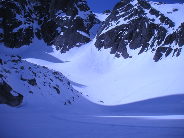
The Caldera Itself
(Above) This picture is similar to the first one, but with the
camera angled more to the right, to look past the rock pile. Notice
that Kenny is zooming down towards me, after highmarking the Caldera.
He did not get too adventurous ... this is avalanche country! Some
of my feeble attempts at highmarking things can be seen at the far
right. A 277 Fan engine only gets you so high ...!
 Copyright © 2011, Ramon Gandia
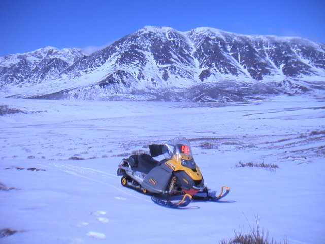
Near Nome River
(Above) After we exited Mosquito Pass, we headed for the truck,
but decided to climb a real steep "pipe". This is a pipe that had
eluded Kenny a few weeks ago. But this time the snow was firmer,
and he not only made it, I did as well with my 300F Tundra. It was
a maximum effort for my machine, I saw the speedo down to 9 MPH and
I thought that it was going to get bogged for sure. But it just
grunted and climbed the damn thing.
Once at the top there was this fairly comfortable mountaintop,
with some bare rock and gravel patches, and a spectacular view.
In this picture I have boxed the south entrance of Mosquito Pass.
I am about the 2,000 ft elevation here. Shortly after I took this
picture I plunged down that same Pipe ... and just about browned my
shorts, it was STEEP with a capital "R" (like in Really Steep!).
Here, as well, you can see what I did to my Tundra. I put in the
wide stance A-arms, the springs, shocks and sway bar from a Back
Country 550. These are non rebuildable gas shocks. I also put in
the belly pan protector. I used to have the A-arm protectors, but
they looked cheesy and useless and I took them off. The original
skis were toasted on the Iron Dog, and I put in the excellent
Pilot 6.9 skis with dual carbides as used in the 07 Summits.
 Copyright © 2011, Ramon Gandia
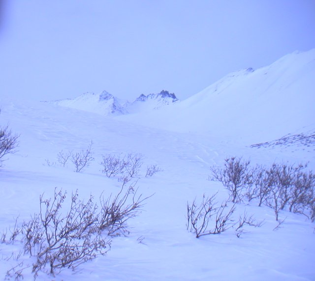
Farewell 2007
(Above) All is well that ends well, and about four miles from this
picture we were back at the road and heading for the truck and trailer.
Here is a pretty scene on the way back. This concludes the 2006-07
Winter snowmachine season for me.
Pictures Copyright as indicated